US Public Land
Dec. 22nd, 2019 10:35 pm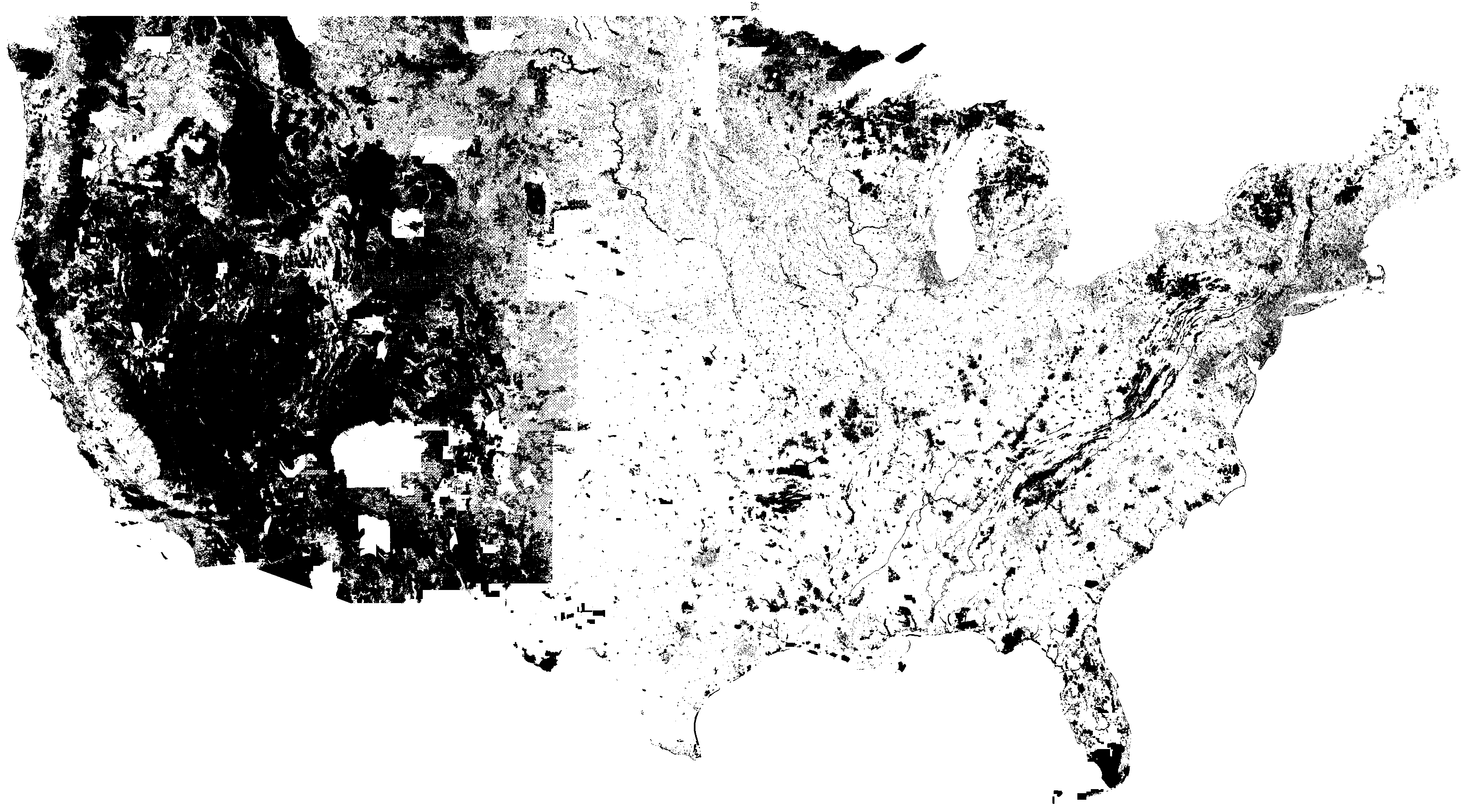
Spent the night creating this, it's a map of all the publicly owned land in the US (Federal, State and Local), shaded in black (click for a much more detailed image).
I don't know why I like this stuff so much, maybe because when I was out west it was crazy how vast and open everything was, and from looking at the map you can kind of see why. A majority of the land is public. Even the big chunks of white in the western states is usually Indian reservations, that are mostly uninhabited.
And then you look at Nebraska, Kansas, Oklahoma and Texas and a majority of it is private land. It's interesting that you can see those state lines so well.
The older I get the more unique I feel the upper midwest (MN, WI, MI) is, and this is another example. Farms to the south, some metro areas, and lots of public lands in the north. The Great Lakes region really has a lot to offer in variation in a short drive (something I noticed in my long route to Madison).
Anyway, thought it was interesting.